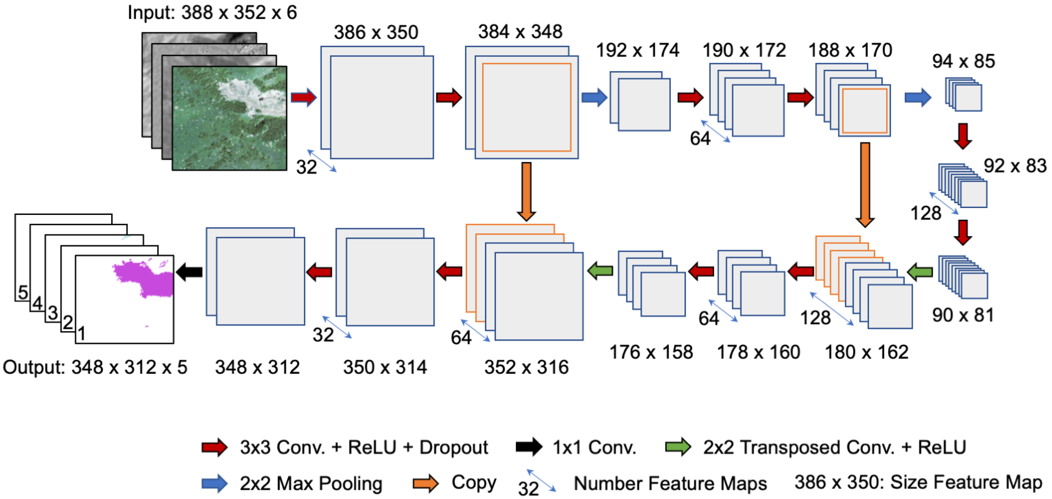
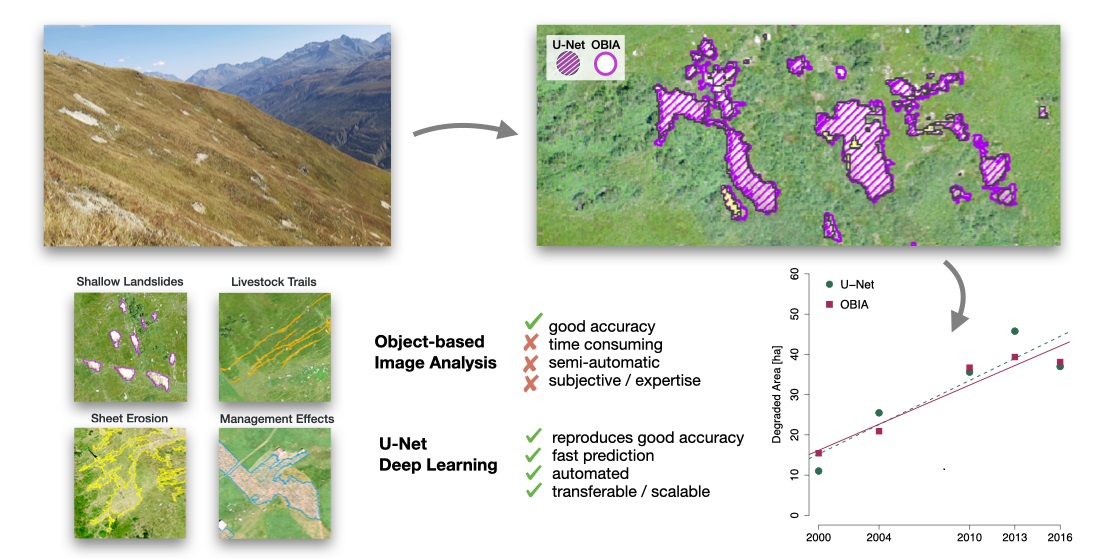
This repository contains a basic implementation for segmenting soil erosion sites on aerial imagery with a U-Net. The code was developped in the context of our paper on "Identifying Soil Erosion Processes in Alpine Grasslands on Aerial Imagery with a U-Net Convolutional Neural Network" (Remote Sensing, 2020).

Our implementation is written in Python (3.6) and uses TensorFlow (version 1.10). If you use the Anaconda distribution (recommended), you can set up your local environment by executing
conda env create -f requirements.yml
or, in case you use a GPU (recommended),
conda env create -f requirements_gpu.yml
Note that the implementation makes use of some auxiliary R-scripts. To use the full capabilities of the provided implementation, a local R installation with the following R libraries is required:
- raster
- rgdal
- optparse
We build our implementation on tf_unet and made some adjustments in the original code.
Are you interested to use some of our code for your research and investigations? In that case please cite our paper:
@article{SamarinZweifel2020,
  title={Identifying Soil Erosion Processes in Alpine Grasslands on Aerial Imagery with a U-Net Convolutional Neural Network},
  author={Samarin*, Maxim and Zweifel*, Lauren and Roth, Volker and Alewell, Christine},
  journal={Remote Sensing},
  volume={12},
  number={24},
  pages={4149},
  year={2020},
  publisher={Multidisciplinary Digital Publishing Institute}
}
